Speleology and cave diving
Speleology and cave diving are direct methods of underground karst forms research, which help understanding of karst to get the real third dimension. Speleology (spelatu – cave; logos – science, greek) is one of the basic methods of solving engineering tasks, related to hydrogeological and engineering geological problems in karst research, which also involves accurate geological mapping of karst channels and caverns
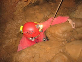
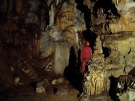
- Photos: Examination of caves of Kučaj and Beljanica mountain (photo by S. Milanović, 2006)
Speleology is a branch of science that studies underground morphological forms, their evolution and speleogenesis in two aspects. First aspect includes study of genesis of speleological forms and geological processes in which they emerge, while second aspect is multidisciplinary, i.e. uses a number of fields (biology – flora and fauna, archeology, hydrogeology etc.) Methodology of speleological researches is carried out in several stages. First stage typically includes informative speleological examination to find out conditions and size of speleological objects, while second stage includes speleological mapping (recording and measurement of karst channels) and (hydro)geological mapping of it. The third and the fourth stage include producing topographic plans and cross-sections, based on data collected in previous two stages, and correlating these with data collected on surface.
During the research, internal database with the most important data about underground karst: name of measurement place, length, azimuth, angle of descent, dimension of channels, (hydro)geological characteristics, photos etc. is formed.
Cadastres of speleogical objects and their content are subject of research of many scientific papers. When it comes problems of hydrogeology, data is primarily collected for genesis (for example genesis of spring or sink), hydrological function (active or periodical flow, dry flow), water regime etc.

- Photo above: Basic form for speleological objects in database of speleological objects (Milanović S., 2005)
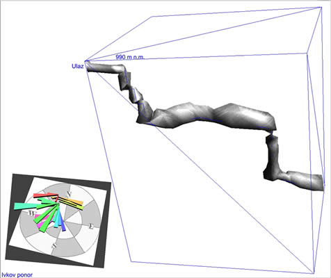
- Photo below: 3D model of cave channels (Milanović S., 2005)
Cave diving has essentially the same aims as speleology, but different research principles and methods. Cave diving research, similarly to speleological research, is carried out in stages, gathering data about topography, visibility, temperature, water flow velocity, maximum research depth, speleofauna presence etc.
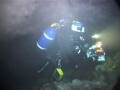
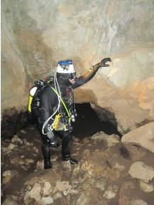
- Photo on the left side: Detail from a cave diving research
- Photo on the right side: Detail from a cave diving research of Malo vrelo spring (Vasić Lj., 2010)
Numerous karst aquifer managment projects are implemented thanks to data and substrates, collected by cave diving. This is the case with springs of Montpellier and Marseille in France, or of Niš in Serbia. It is often that robotic devices and cameras (ROV) are used in channels either impassable or too deep. One of the most interesting and the deepest karst syphons, Fontaine de Vaucluse spring in France was explored to a depth of 308 m in this way, while the first attempt of a dive in that spring dates from 1878 (Ottonelli).
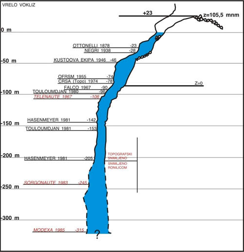

- Sketch above: Dive history of Fontaine de Vaucluse spring (modificatation based on data from „Museum de Monde Souterrain“) (in: Milanović S., 2006)
- Photo below: Jacques Cousteau in his first dive attempt in Fontaine de Vaucluse spring (in: Milanović S., 2012)